U.S. flag

An official website of the United States government

Official websites use .gov
A .gov website belongs to an official government organization in the United States.

Secure .gov websites use HTTPS
A lock ( ) or https:// means you’ve safely connected to the .gov website. Share sensitive information only on official, secure websites.

people sitting outside at tables on the street

Mass Ave Planning Study - Cambridge Common to Alewife Brook Parkway

logo in red, green, blue, and orange

The Mass Ave Planning Study (MAPS), spearheaded by the Cambridge Community Development Department, is creating a vision plan for what Massachusetts Avenue will look like in 2040 between Alewife Brook Parkway and Cambridge Common. 

This plan is part of the implementation of Envision Cambridge, the City's comprehensive plan. It will study various aspects such as land use, zoning, urban design, housing, climate resiliency, small business support, mobility, and public space.

The team will work with the community to develop a shared vision to shape future development types and scales, and lead an engagement process to capture all the voices that call this part of Mass Ave home.

Sign Up for Project Update

Latest Updates

Mass Ave Collaboration Map!

The Mass Ave Planning Study team has created an online mapping tool for anyone to provide their input and feedback on the part of Mass Ave within our study area. You can point out areas you love, places that need improvement, and opportunities for change. The mapping tool will help the planning team uncover pressing issues and gather ideas for the planning study.

You can also submit comments via our feedback form. We take all forms of feedback into consideration. Please take a moment and explore the map!

Submit Feedback Start Mapping!

Community Engagement

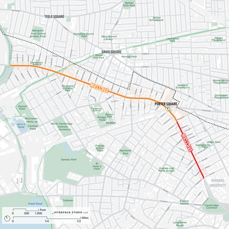
South of Porter Square Focus Area - Round 2 meetings

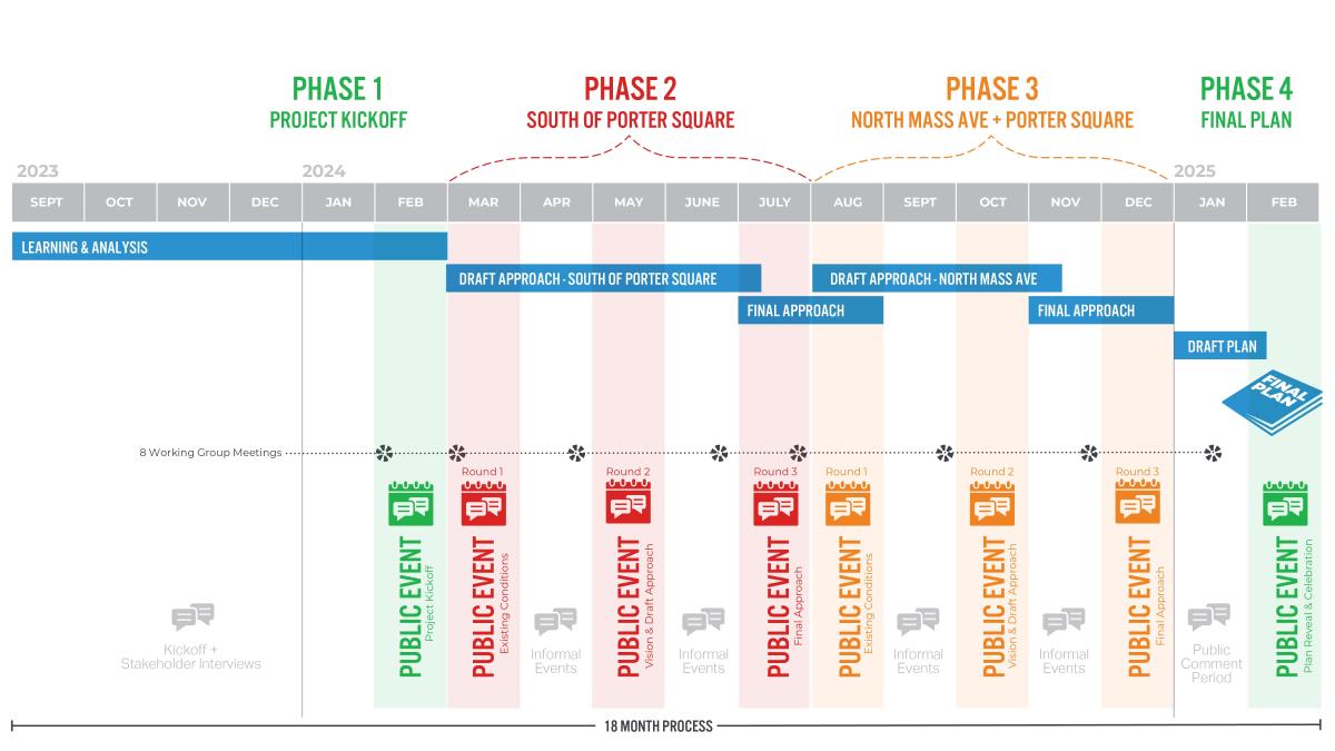
Phase 1 (South of Porter) Round 2 meetings for the Mass Ave Planning Study will continue our focus on the area South of Porter Square. The second round of meetings for this phase summarize feedback from our first round of South of Porter meetings, present draft goals, and highlight early ideas for this area of Mass Ave. Our intention for this moment is to collaboratively refine the goals and draft ideas.  

Working Group  April 24, 6:00 p.m. - 7:30 p.m.

In our April MAPS Working Group meeting we walked Mass Ave between Cambridge Common and Roseland Street, discussed the existing conditions of this area and what the future scale, density, public space and character of the area could be like. We also had discussions on how it ties to the feedback we heard in our March Community Meeting. Please see the link in the Meeting Materials section to view the brief presentation.

Community Meeting May 29, 5:30 p.m. - 7:30 p.m.

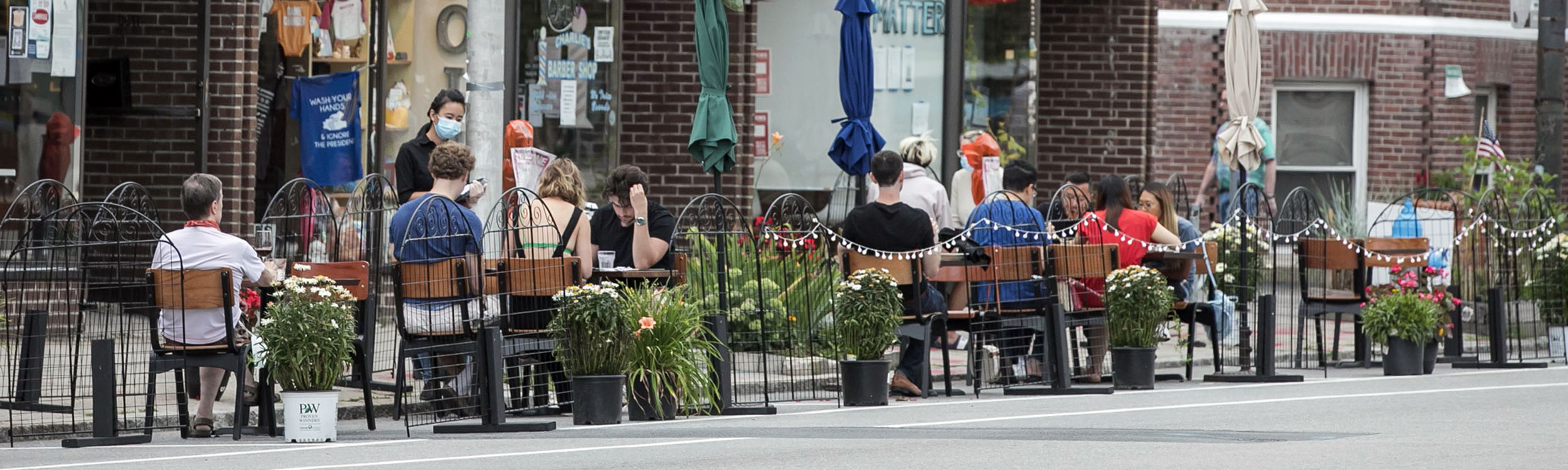
Please join us in-person for a Mass Ave Planning Study community meeting. This will be the second meeting focusing on the area South of Porter Square.

The Community Development Department will be sharing a draft vision and potential ideas for the South of Porter Square planning area. We will host an open house format event, allowing participants to talk with planning team members about the future of the area. 

The meeting will be located in the courtyard of Lesley University Lunder Arts Center on Mass Ave. In the event of rain, the open house will be moved indoors to the atrium space at Lunder Arts Center. Snacks and beverages will be served! Stop by anytime to provide your feedback!

Location: Lesley University Lunder Arts Center, 1801 Mass Ave.

Registration is not required, but it is encouraged. Please go to https://bit.ly/3Hy1Ovh to register.

Meeting Materials

Working Group Meetings

  • MAPS Working Group - Meeting 3 (South of Porter) 04/24/24 presentation
  • MAPS Working Group - Meeting 2 (South of Porter) 03/14/24 video
  • MAPS Working Group - Meeting 2 (South of Porter) 03/14/24 presentation
  • MAPS Working Group - Meeting 1 02/08/24 video
  • MAPS Working Group - Meeting 1 02/08/24 presentation

Community Meetings


Working Project Schedule

Graphic schedule with colored bars

Study Area

The Study Area for the Mass Ave Planning Study stretches from the Cambridge Common to Alewife Brook Parkway, two miles of Mass Ave. 

map with streets and colored lines

Key Resources

Local and Area Plans

Citywide Plans

Links to Neighborhood Planning

Mass Ave Planning Study Working Group

For a more complete description of the working group and its members please reference the City Council packet from January 22, 2024 (page 88)

Stay Informed

Sign up to receive project-specific email updates.   


Contact Us

How can we help?

Please provide as much detail below as possible so City staff can respond to your inquiry:

As a governmental entity, the Massachusetts Public Records Law applies to records made or received by the City. Any information received through use of this site is subject to the same provisions as information provided on paper.

Read our complete privacy statement


Service Requests

Enter a service request via SeeClickFix for things like missed trash pickups, potholes, etc., click here